1. Multi-source remote sensing data fusion for land cover classification
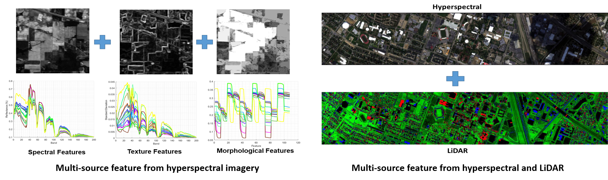
Remote sensing data analysis has gained attention in recent years due to the development of a wide range of sensing technologies. Among the different types of analysis, particular attention has been given to classification which consists of assigning a label to each pixel in order to generate a thematic land-cover map. Disparate features either from the same (e.g., spectral and spatial information) or different sensors (e.g., hyperspectral and LiDAR) are often combined as they can provide complementary information, and therefore improve the classification performance. My work is to develop effective supervised classification frameworks to fully utilize the multi-source data, with the goal of generating accurate classification maps.
2. Machine learning algorithm developments for multi-source data fusion
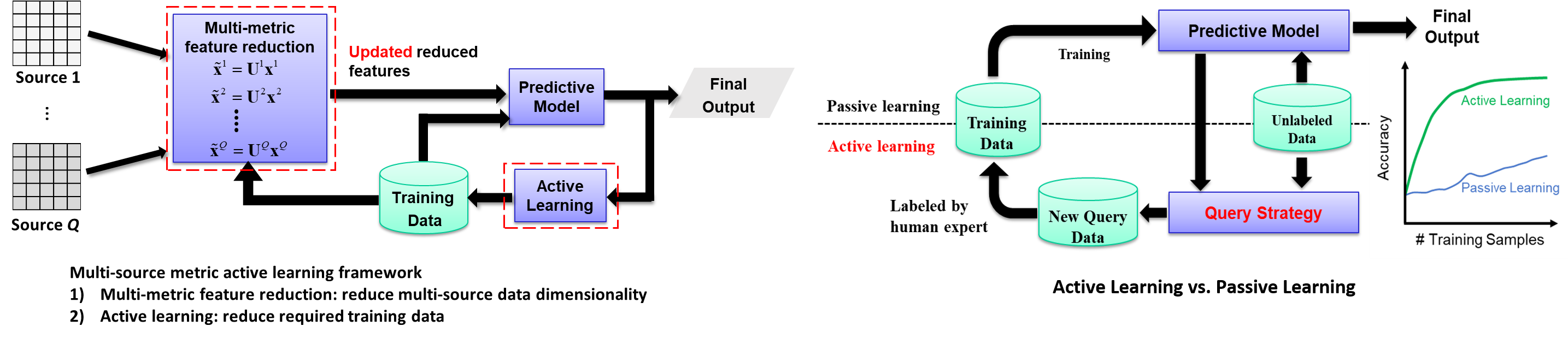
Supervised learning in general is affected by two key problems: high dimensionality of the input data and limited number of labeled samples. The high dimensionality problem can be addressed through feature reduction strategies. Active learning (AL), which aims to select the most informative samples for training the model, has also been demonstrated to be an effective approach for dealing with the limited availability of labeled samples. While most research has focused on addressing the two aforementioned problems independently, I aim to integrate the feature reduction and AL steps into a unique framework to solve the two fundamental supervised learning problems together.
3. Crop yield prediction with remote sensing and machine learning
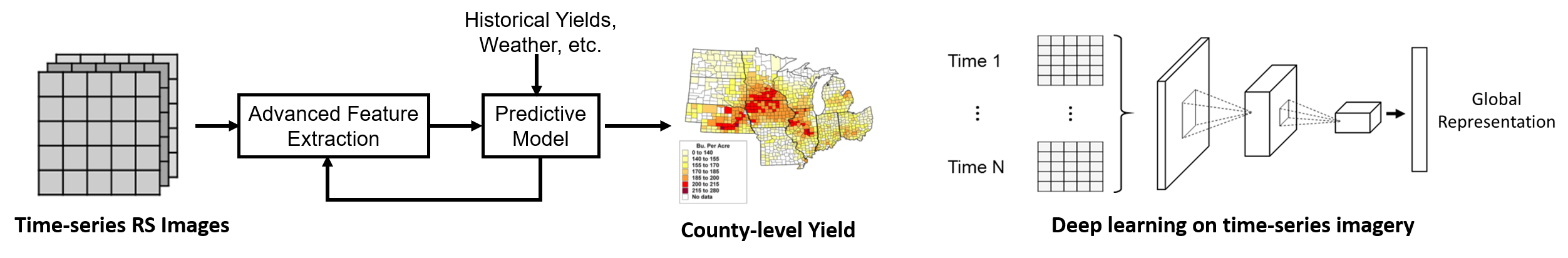
Accurate early season yield prediction is important for farm resource management (e.g. nitrogen and water management) and market planning. Currently, crop yields are forecast based on field surveys, which is labor intensive and time consuming. Satellite remote sensing, on the other hand, provides consistent, spatially extensive measurements covering the visible and infrared spectrum, and thus has great potential for crop yield analysis. My goal is to build advanced machine learning models, such as deep learning, to extract the informative features (e.g. tree vigor and flower condition) from the time-series remote sensing imagery, and then combine them with other input data (e.g. weather data, historical yields) for the end-of-season yield prediction.
4. High-throughput plant phenotyping with unmanned aerial vehicles (UAVs)
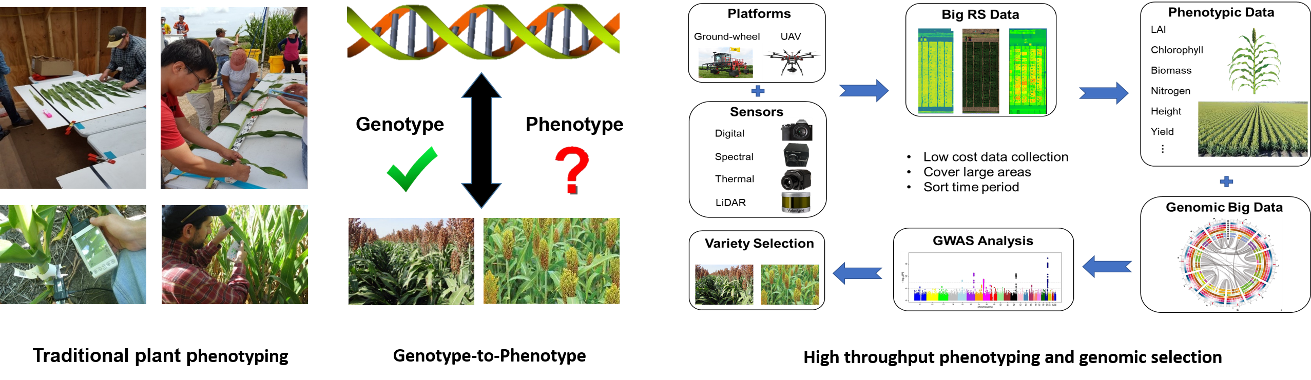
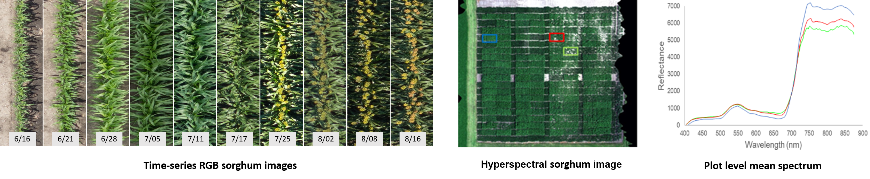
Plant phenotypes refer to measurable characteristics (e.g. plant height, leaf counts, and biomass), which result from differences in genotypes and environmental conditions. Traditional phenotyping is based on manual data collection, which dramatically limits available data, and thus efficiency of matching phenotypic information with genomic data. High-throughput image based phenotyping approaches for field crops provide a non-destructive, non-invasive alternative to speed up linking associations with genotypes, leading to reduced breeding cycles for acquisition of desired traits. UAVs are potential platforms for plant phenotyping because of their capability to acquire high spatial and temporal resolution data.
